Galway · Cycling

Connemara · Cycling Loops

Choose a published Connemara cycling loop around Clifden, the coast or the Renvyle area.

Choice of published road loops · Shared roads
Cycling route guide. Key planning locations only; this map does not trace the trail. This is a route overview, not live navigation. Follow local signs and road notices. Planning places only, not a traced cycling line. Choose the current official route map and check access, surface, traffic and technical grade before riding. Official visitor information ↗

Explore the planning places

The map loads from OpenStreetMap when you choose to open it. You can also use the town list below.

Planning places · use the official route map for the full alignment

Approximate town-centre markers; not attraction entrances or business addresses. Map: © OpenStreetMap contributors. Planning localities: GeoNames (CC BY 4.0) and OpenStreetMap contributors (ODbL). No trail line is drawn. Town and area markers only; no business pins.

Make time for the places along the way

This is a collection of road-cycling choices, not a single continuous loop through every planning town. Select one named route and use its published map for the distance, start and road connections.

These are shared roads with narrow and exposed stretches. Plan the day around ability, wind and daylight, and check cycle hire or assistance separately.
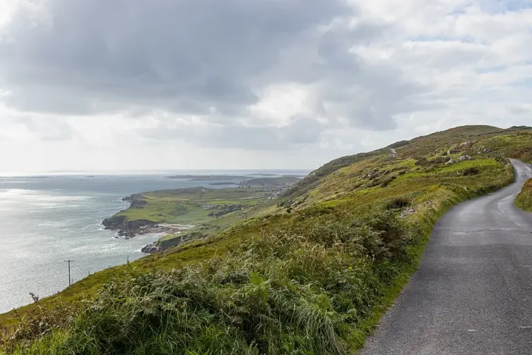
The Sky Road above the Atlantic near ClifdenClifden’s Sky Road: choose a clear day and an unhurried circuit
Photo: Superbass · Source · CC BY-SA 4.0. Resized and converted to WebP; metadata removed. No scene changes. The derivative retains the source licence. Display preview cropped to fit.
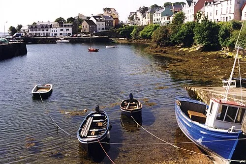
Boats and waterfront buildings at Roundstone harbourRoundstone: begin at the harbour and let the day grow
Photo: Anne Burgess · Source · CC BY-SA 2.0. Resized and converted to WebP; metadata removed. No scene changes. The derivative retains the source licence. Display preview cropped to fit.
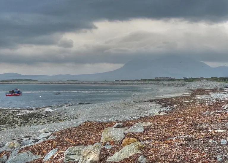
The Renvyle coast with Mweelrea beyond the waterRenvyle Peninsula: give the smaller roads and shore stops time
Photo: michael clarke stuff · Source · CC BY-SA 2.0. Resized and converted to WebP; metadata removed. No scene changes. The derivative retains the source licence. Display preview cropped to fit.

Plan with the tourism route guide and further visitor information. Local signs and current notices take precedence over this overview.

Save journeys and favourite places in the Ramble Journeys app →