Scenic drives · Discover the places along the way

Hook Peninsula · Touring Circuit

Choose a touring day around Hook’s harbour villages, beaches and lighthouse coast.

Scenic driving · Towns, stories and local businesses
A scenic road journey. Explore the published touring area, with nearby visits planned separately. This is a route overview, not live navigation. Follow local signs and road notices. Suggested public-road connections between the promoted stops. Optional walks, attraction entrances and side trips need separate planning. Follow local signs, road restrictions and current conditions. This overview is not live navigation. Official visitor information ↗

See the towns on the map

The map loads from OpenStreetMap when you choose to open it. You can also use the town list below.

Hook Peninsula · Touring Circuit · mapped circuit approximately 45 km

Approximate town-centre markers; not attraction entrances or business addresses. Map: © OpenStreetMap contributors. Road data © OpenStreetMap contributors (ODbL), route trace prepared with BRouter; checked against the tourism guide, 21 November 2026. Not live navigation. Town and area markers only; no business pins.

Make time for the places along the way

This is a suggested road circuit joining places around the promoted Hook Peninsula, not a compulsory signed loop. The lighthouse end is a return spur and attraction visits need their own opening and parking checks.

The Ballyhack ferry is an optional arrival connection, not part of this circuit. Plan Tintern, beach activities and walking tours separately, checking the extra distance and access rather than assuming everything is directly beside the road.
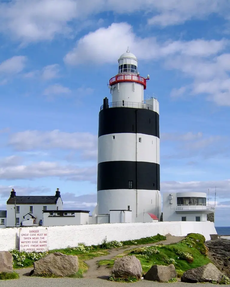
Hook Lighthouse and adjoining buildingsHook Lighthouse: climb the tower with its working purpose in mind
Photo: Athena Flickr · Source · CC BY 2.0. Resized and converted to WebP; metadata removed. No scene changes. The derivative retains the source licence. Display preview cropped to fit.
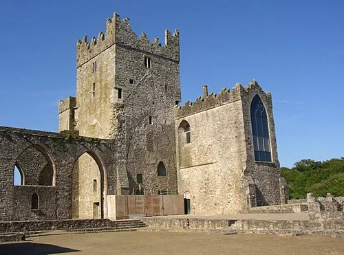
Surviving walls and tower of Tintern Abbey in County WexfordTintern Abbey: distinguish the medieval ruins from the later family home
Photo: Humphrey Bolton · Source · CC BY-SA 2.0. Resized and converted to WebP; metadata removed. No scene changes. The derivative retains the source licence. Display preview cropped to fit.
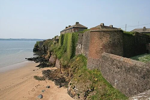
Bastioned walls of Duncannon Fort above the shoreDuncannon Fort: understand the harbour from a defensive viewpoint
Photo: Brian Hodge · Source · CC BY-SA 2.0. Resized and converted to WebP; metadata removed. No scene changes. The derivative retains the source licence. Display preview cropped to fit.

Plan with the tourism route guide and further visitor information. Local signs and current notices take precedence over this overview.

Save journeys and favourite places in the Ramble Journeys app →