
Kilkenny · Walking
Nore Valley · Thomastown to Inistioge
Choose the southern Nore Valley section for a walking day between Thomastown and Inistioge.
Published linear section · Check current trail conditionsExplore the planning places
The map loads from OpenStreetMap when you choose to open it. You can also use the town list below.
Planning places · use the official route map for the full alignment
Approximate town-centre markers; not attraction entrances or business addresses. Map: © OpenStreetMap contributors. Planning localities: GeoNames (CC BY 4.0) and OpenStreetMap contributors (ODbL). No trail line is drawn. Town and area markers only; no business pins.
Make time for the places along the way
This is a separate published section from the Kilkenny-to-Bennettsbridge trail. Do not assume a continuous public riverside path connects every town along the Nore.
Use the current Trail Kilkenny section map and check access and river conditions. Arrange the return independently and allow time for the towns without leaving the permitted path.
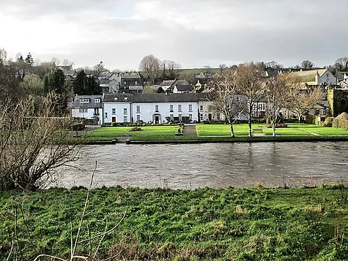
Inistioge: keep a village visit separate from the climb to Woodstock
The Nore Valley Walk: plan one signed section and its returnPlan with the tourism route guide and further visitor information. Local signs and current notices take precedence over this overview.