
Kerry · Walking

Glanteenassig · Woodland Visit

Glanteenassig offers woodland and lake views within a sheltered Slieve Mish valley, with several routes that suit different amounts of walking. It is a useful place to leave the coastal road for a while. Choose a named trail before setting out rather than treating the forest’s broad landscape as one unrestricted route.

Choose a marked walk · Check the selected trail
Walking route guide. Key planning locations only; this map does not trace the trail. This is a route overview, not live navigation. Follow local signs and road notices. The marker shows a nearby planning locality, not the park entrance or a walking line. Follow the official visitor directions and current marked trails. Check gates, weather, forestry operations and local closures before travelling. Official visitor information ↗

Explore the planning places

The map loads from OpenStreetMap when you choose to open it. You can also use the town list below.

Planning places · use the official route map for the full alignment

Approximate town-centre markers; not attraction entrances or business addresses. Map: © OpenStreetMap contributors. Planning localities: GeoNames (CC BY 4.0) and OpenStreetMap contributors (ODbL). No trail line is drawn. Town and area markers only; no business pins.

Make time for the places along the way

Coillte distinguishes the short Lough Slat approach, the River Trail and the moderate Lough Caum Loop. Their distances and surfaces differ. Read the current trailhead information and choose the least demanding option that still gives everyone the outing they want. A modest lakeside pause can be more satisfying than attempting a longer circuit simply because it appears on the map.

Check current Coillte notices, gate hours and route conditions. Wear grippy footwear and choose a trail suitable for your mobility and experience. Fishing needs separate local permit checks. Do not interpret possible mountain access as a marked, prepared extension of a lakeside walk.
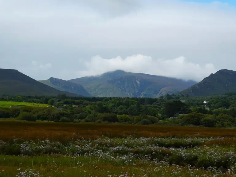
Caher Marsh with Glanteenassig in the background, viewed from the Dingle WayGlanteenassig: choose a lakeside trail in the Slieve Mish valley
Photo: Maoileann · Source · CC BY-SA 4.0. Resized and converted to WebP; metadata removed. No scene changes. The derivative retains the source licence. Display preview cropped to fit.

Plan with the tourism route guide and further visitor information. Local signs and current notices take precedence over this overview.

Save journeys and favourite places in the Ramble Journeys app →

More forest parks & woodland days, county by county →