
Make time for the places along the way
Official tourism describes a 207 km Shannon Estuary Way. This suggested shorter circuit connects the main estuary towns with a Tarbert–Killimer ferry crossing; it is not the complete signed 207 km alignment. Use the official guide when planning the full route.
Check the current ferry timetable, fares, vehicle restrictions and weather before setting out. A Scattery Island trip is a separate boat excursion, and visits to heritage sites need their own opening and parking checks.
 Foynes Flying Boat Museum: follow the Shannon’s aviation story

 Glin: a Shannon estuary stop with room to slow down

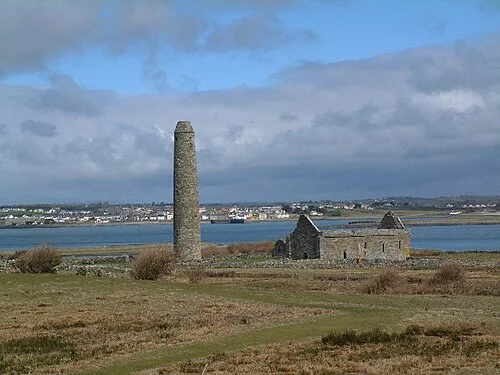 Scattery Island: make the boat trip part of the history

Plan with the tourism route guide and further visitor information. Local signs and current notices take precedence over this overview.