Scenic drives · Discover the places along the way

Slea Head Drive

Follow the peninsula west from Dingle through Ventry, the Slea Head coast and the villages beyond. Pick a starting stop and explore this clockwise coastal loop at your own pace.

Scenic driving · Towns, stories and local businesses
A scenic road journey. Explore the published touring area, with nearby visits planned separately. This is a route overview, not live navigation. Follow local signs and road notices. Drive clockwise as advised by the local tourism guide. Roads are narrow in places; use designated parking, respect passing places and follow current local signs. Nearby sites may require a detour. Official visitor information ↗

See the towns on the map

The map loads from OpenStreetMap when you choose to open it. You can also use the town list below.

Slea Head Drive · mapped circuit approximately 43 km

Approximate town-centre markers; not attraction entrances or business addresses. Map: © OpenStreetMap contributors. Road data © OpenStreetMap contributors (ODbL), route trace prepared with BRouter; checked against the tourism guide, 20 November 2026. Not live navigation. Town and area markers only; no business pins.

Make time for the places along the way

Slea Head is a journey through a living Gaeltacht landscape, with villages, farmland, stone-built heritage and the Atlantic close together. Begin with time in Dingle, then look beyond a photograph-only circuit: a beach visit, a heritage stop or a quiet lunch can give the day its own shape.

The Blasket Centre and Gallarus Oratory are linked as visits to plan separately from the driving line. Island trips need their own booking and weather check. The local tourism guide advises driving clockwise; this journey keeps that direction rather than offering an opposing circuit.
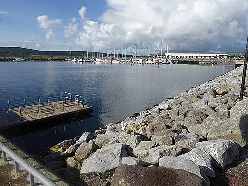
Boats and buildings at Dingle HarbourDingle town: leave a day for the harbour and its streets
Photo: Oliver Dixon  · Source · CC BY-SA 2.0. Resized and converted to WebP; metadata removed. No scene changes. The derivative retains the source licence. Display preview cropped to fit.
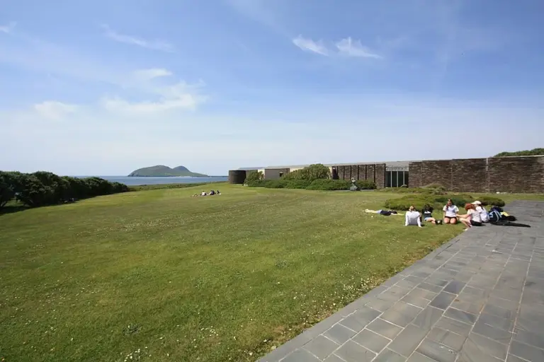
The Blasket Centre and grounds in Dún ChaoinThe Blasket Centre: begin the island story on the mainland
Photo: Irish Studies · Source · CC BY 2.0. Resized and converted to WebP; metadata removed. No scene changes. The derivative retains the source licence. Display preview cropped to fit.
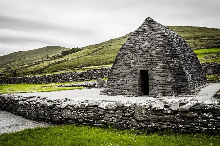
Gallarus Oratory and its stone enclosureGallarus Oratory: look closely at the stonework
Photo: Dieglop · Source · CC BY-SA 4.0. Resized and converted to WebP; metadata removed. No scene changes. The derivative retains the source licence. Display preview cropped to fit.

Plan with the tourism route guide and further visitor information. Local signs and current notices take precedence over this overview.