Leitrim · Cavan · Walking

Leitrim Way

Connect Leitrim’s uplands and waterside villages on a walking trip planned in stages.

About 56 km · Multi-day walking
Walking route guide. Key planning locations only; this map does not trace the trail. This is a route overview, not live navigation. Follow local signs and road notices. Planning locations only, not a traced walking path. Use the current official trail map and waymarkers, check access and weather, and plan the return or onward transport before setting out. Official visitor information ↗

Explore the planning places

The map loads from OpenStreetMap when you choose to open it. You can also use the town list below.

Planning places · use the official route map for the full alignment

Approximate town-centre markers; not attraction entrances or business addresses. Map: © OpenStreetMap contributors. Planning localities: GeoNames (CC BY 4.0) and OpenStreetMap contributors (ODbL). No trail line is drawn. Town and area markers only; no business pins.

Make time for the places along the way

The current county guide describes a journey between Manorhamilton and Leitrim Village. Use its stage maps to organise the walking through Boleybrack and the Dowra area, rather than following straight lines between these pins.

Arrange accommodation and transport around the real stage endpoints. Wet ground and remote sections need appropriate equipment, daylight and current access checks.

Sheep on a stony track on the Leitrim WayThe Leitrim Way: pick a stage before setting out
Photo: WalkinLeitrim · Source · CC BY-SA 4.0. Resized and converted to WebP; metadata removed. No scene changes. The derivative retains the source licence. Display preview cropped to fit.
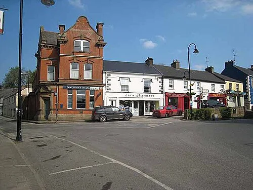
Buildings around Market Square in DrumshanboDrumshanbo: a day around the town and the lake
Photo: Oliver Dixon · Source · CC BY-SA 2.0. Resized and converted to WebP; metadata removed. No scene changes. The derivative retains the source licence. Display preview cropped to fit.
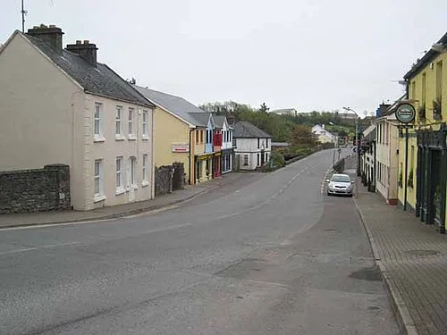
An archive view along Main Street in Leitrim VillageLeitrim Village: a base beside two Blueways
Photo: Oliver Dixon · Source · CC BY-SA 2.0. Resized and converted to WebP; metadata removed. No scene changes. The derivative retains the source licence. Display preview cropped to fit.

Plan with the tourism route guide and further visitor information. Local signs and current notices take precedence over this overview.

Save journeys and favourite places in the Ramble Journeys app →