Scenic drives · Discover the places along the way

Shannon Estuary Way · Shorter Touring Circuit

Explore both shores of the Shannon Estuary, with a ferry crossing connecting the Kerry and Clare sides.

Scenic driving · Towns, stories and local businesses
A scenic road journey. Explore the published touring area, with nearby visits planned separately. This is a route overview, not live navigation. Follow local signs and road notices. Road and ferry overview. The Tarbert–Killimer crossing is required for this circuit; check current service, fares and vehicle limits with Shannon Ferries. Do not treat the water crossing as a road. Not live navigation. Official visitor information ↗

See the towns on the map

The map loads from OpenStreetMap when you choose to open it. You can also use the town list below.

Shannon Estuary Way · Shorter Touring Circuit · mapped circuit approximately 148 km · ferry shown separately

Approximate town-centre markers; not attraction entrances or business addresses. Map: © OpenStreetMap contributors. Public-road legs: OpenStreetMap contributors (ODbL), BRouter. Dashed blue line: schematic ferry connection between verified terminals, not vessel navigation. Check service and local signs. Town and area markers only; no business pins.

Make time for the places along the way

Official tourism describes a 207 km Shannon Estuary Way. This suggested shorter circuit connects the main estuary towns with a Tarbert–Killimer ferry crossing; it is not the complete signed 207 km alignment. Use the official guide when planning the full route.

Check the current ferry timetable, fares, vehicle restrictions and weather before setting out. A Scattery Island trip is a separate boat excursion, and visits to heritage sites need their own opening and parking checks.
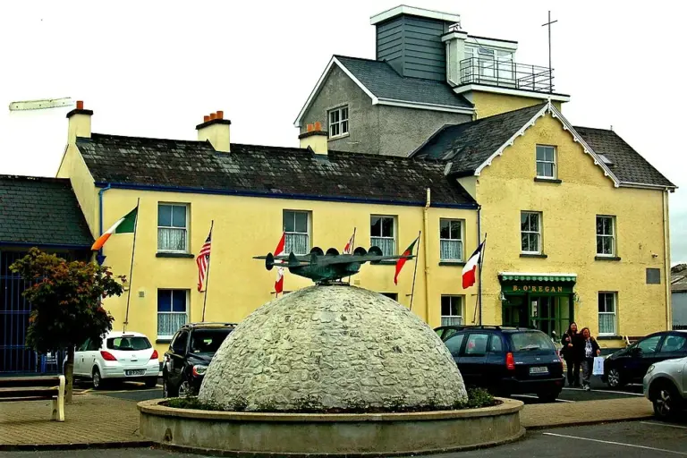
The flying-boat terminal and museum building in FoynesFoynes Flying Boat Museum: follow the Shannon’s aviation story
Photo: Joseph Mischyshyn  · Source · CC BY-SA 2.0. Resized and converted to WebP; metadata removed. No scene changes. The derivative retains the source licence. Display preview cropped to fit.
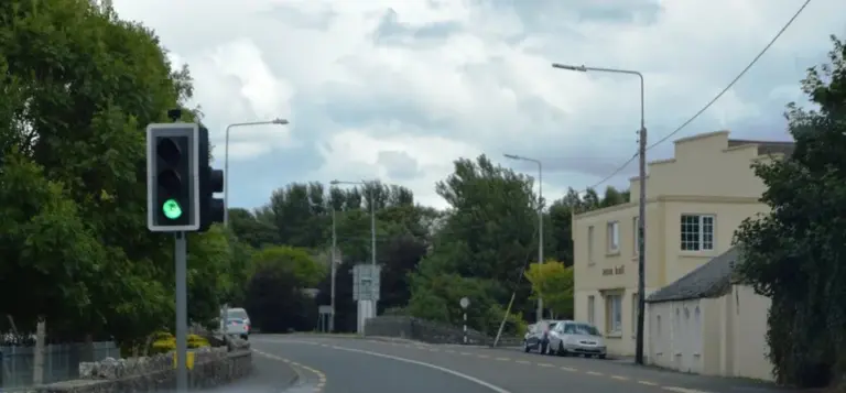
The N69 passing through Glin villageGlin: a Shannon estuary stop with room to slow down
Photo: N Chadwick · Source · CC BY-SA 2.0. Resized and converted to WebP; metadata removed. No scene changes. The derivative retains the source licence. Display preview cropped to fit.
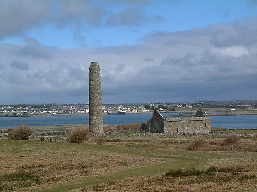
The round tower on Scattery IslandScattery Island: make the boat trip part of the history
Photo: Charles W Glynn · Source · CC BY-SA 2.0. Resized and converted to WebP; metadata removed. No scene changes. The derivative retains the source licence. Display preview cropped to fit.

Plan with the tourism route guide and further visitor information. Local signs and current notices take precedence over this overview.

Save journeys and favourite places in the Ramble Journeys app →