Scenic drives · Discover the places along the way

Connemara Loop

Make a Connemara circuit through the Killary, Renvyle and Inagh Valley landscapes, with villages to explore between the views.

Scenic driving · Towns, stories and local businesses
A scenic road journey. Explore the published touring area, with nearby visits planned separately. This is a route overview, not live navigation. Follow local signs and road notices. Suggested public-road connections between the promoted stops. Optional walks, attraction entrances and side trips need separate planning. Follow local signs, road restrictions and current conditions. This overview is not live navigation. Official visitor information ↗

See the towns on the map

The map loads from OpenStreetMap when you choose to open it. You can also use the town list below.

Connemara Loop · mapped circuit approximately 94 km

Approximate town-centre markers; not attraction entrances or business addresses. Map: © OpenStreetMap contributors. Road data © OpenStreetMap contributors (ODbL), route trace prepared with BRouter; checked against the tourism guide, 21 November 2026. Not live navigation. Town and area markers only; no business pins.

Make time for the places along the way

The published loop connects Maam Cross and Leenane with the northwestern coast before returning through Letterfrack, Kylemore and the Inagh Valley. Choose stops around the day’s weather rather than treating it as a race between viewpoints.

The national park walks, abbey visit and beaches each need time away from the road. Use current entrance and parking advice; a mountain or beach appearing nearby does not make it part of the driving line.
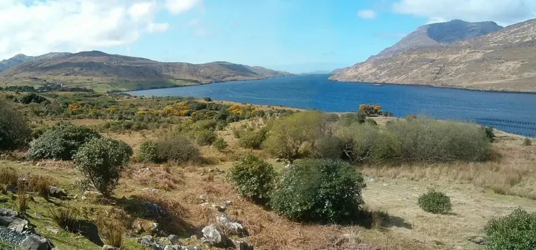
The water and surrounding mountains at Killary HarbourKillary Fjord by boat: let the shore come to you
Photo: No machine-readable author provided. El Comandante assumed (based on copyright claims). · Source · Public domain. Resized and converted to WebP; metadata removed. No scene changes. The derivative retains the source licence. Display preview cropped to fit.
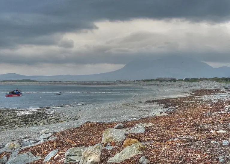
The Renvyle coast with Mweelrea beyond the waterRenvyle Peninsula: give the smaller roads and shore stops time
Photo: michael clarke stuff · Source · CC BY-SA 2.0. Resized and converted to WebP; metadata removed. No scene changes. The derivative retains the source licence. Display preview cropped to fit.
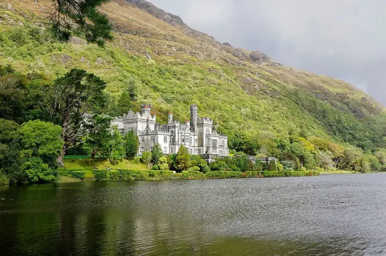
Kylemore Abbey below a wooded mountainside beside the lakeKylemore Abbey: leave time beyond the lakeside photograph
Photo: Berthold Werner · Source · CC BY-SA 4.0. Resized and converted to WebP; metadata removed. No scene changes. The derivative retains the source licence. Display preview cropped to fit.

Plan with the tourism route guide and further visitor information. Local signs and current notices take precedence over this overview.

Save journeys and favourite places in the Ramble Journeys app →