Scenic drives · Discover the places along the way

Donegal Route 4 · Eastern Foothills

Explore eastern Donegal from the Twin Towns towards the Foyle and Letterkenny, with heritage visits along the way.

Scenic driving · Towns, stories and local businesses
A scenic road journey. Explore the published touring area, with nearby visits planned separately. This is a route overview, not live navigation. Follow local signs and road notices. Suggested public-road connections between the promoted stops. Optional walks, attraction entrances and side trips need separate planning. Follow local signs, road restrictions and current conditions. This overview is not live navigation. Official visitor information ↗

See the towns on the map

The map loads from OpenStreetMap when you choose to open it. You can also use the town list below.

Donegal Route 4 · Eastern Foothills · mapped road approximately 98 km

Approximate town-centre markers; not attraction entrances or business addresses. Map: © OpenStreetMap contributors. Road data © OpenStreetMap contributors (ODbL), route trace prepared with BRouter; checked against the tourism guide, 21 November 2026. Not live navigation. Town and area markers only; no business pins.

Make time for the places along the way

The county’s fourth touring route starts around Ballybofey and Stranorlar and finishes in Letterkenny. This overview follows public-road connections between its towns rather than presenting the outing as a closed coastal loop.

The fort approach and Inch Island reserve are separate visits from their nearby town pins. Use each attraction’s directions and access notices; being near a heritage site does not establish an open entrance or a suitable walking connection.
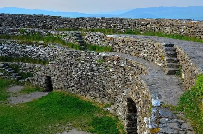
Stone walls and terraces at Grianán of AileachGrianán of Aileach: a stone fort above the two loughs
Photo: Guyw4444 · Source · CC BY-SA 4.0. Resized and converted to WebP; metadata removed. No scene changes. The derivative retains the source licence. Display preview cropped to fit.
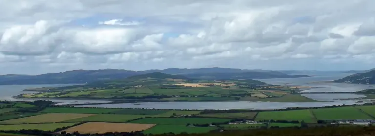
Inch Island and the surrounding waters and fieldsInch Wildfowl Reserve: a quieter side of Inishowen
Photo: Pampuco · Source · CC BY-SA 4.0. Resized and converted to WebP; metadata removed. No scene changes. The derivative retains the source licence. Display preview cropped to fit.
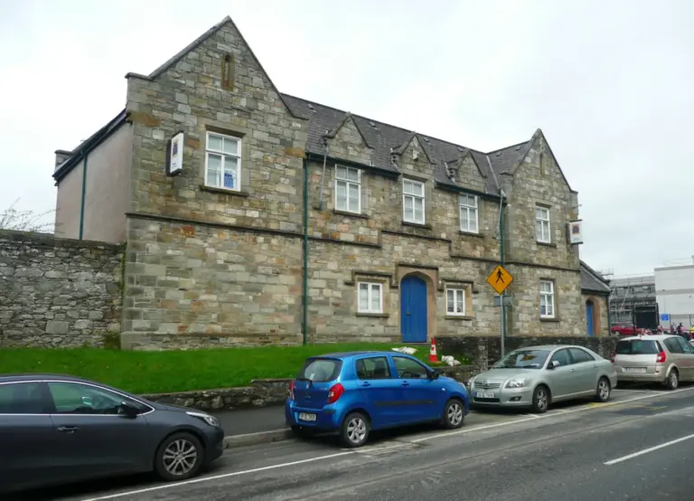
Donegal County Museum on a Letterkenny streetDonegal County Museum: begin Letterkenny with the county’s story
Photo: Humphrey Bolton  · Source · CC BY-SA 2.0. Resized and converted to WebP; metadata removed. No scene changes. The derivative retains the source licence. Display preview cropped to fit.

Plan with the tourism route guide and further visitor information. Local signs and current notices take precedence over this overview.

Save journeys and favourite places in the Ramble Journeys app →