Donegal · Walking
Inishowen Head Loop
Explore the eastern side of Inishowen on foot, with Greencastle as a nearby base.
Published coastal loop · Check current trail gradeExplore the planning places
The map loads from OpenStreetMap when you choose to open it. You can also use the town list below.
Planning places · use the official route map for the full alignment
Approximate town-centre markers; not attraction entrances or business addresses. Map: © OpenStreetMap contributors. Planning localities: GeoNames (CC BY 4.0) and OpenStreetMap contributors (ODbL). No trail line is drawn. Town and area markers only; no business pins.
Make time for the places along the way
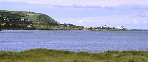
The Inishowen Head Loop is a named walking route, separate from the Inishowen 100 drive. Use its current waymarked map to find the actual starting area near Shroove.
Prepare for exposed coastal ground and changing weather. A nearby beach or lighthouse is not an instruction to leave the permitted path; plan these visits separately.
The Inishowen 100: turn the circuit into a few good days
Malin Head: leave time for the northern coastPlan with the tourism route guide and further visitor information. Local signs and current notices take precedence over this overview.