
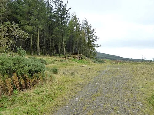
Forest-track context below Loughanleagh, not a guaranteed ridge view. Photo: Oliver Dixon · CC BY-SA 2.0. Resized and converted for the web. Full credit.

Loughanleagh rises between Bailieborough and Kingscourt, offering a hill outing with forest, open views and local heritage in close company. There are several walks here rather than one universal circuit. For a defined first route, the Heritage Trust’s red Adrian’s Way loop gives a clear starting point and a manageable plan for a prepared walker.
Begin at the picnic area
The Trust describes a start at Mohercrum’s picnic area, with red signs leading towards the forest. Read its current map before walking. Different coloured trails have different routes, so matching a sign to the intended circuit matters more than following the widest available track.
Enjoy the view without counting counties
On a clear day the ridge offers a broad sense of east Cavan and the country beyond. Cloud or haze may hide distant landmarks. Give attention to the nearer fields and changing woodland as well, rather than measuring the outing against a promised panoramic photograph.
Treat the heritage gently
Cairns and the mass rock belong to a landscape with many layers of memory. Stay on permitted approaches, leaving stones and vegetation undisturbed. Stories associated with the hill can enrich the visit while remaining distinct from a claim that every tradition is proven history.
Before you go
The Trust lists this red loop at 4.5 kilometres, moderate, with mountain and forest paths plus public road. It describes loose stone on the descent and a steep road ascent on the return, so suitable footwear and enough daylight are essential. Use the current map, heed forestry restrictions and take care around traffic. Keep dogs leashed and clean up after them. Carry water and a layer for an exposed viewpoint. This is a different route from longer generic seven-kilometre descriptions of Loughanleagh. The photograph illustrates a forest track in the area, not the present condition of every section or an assured summit view.
Plan your visit
Loughanleagh and Muff Heritage Trust: Adrian’s Way red loop
More in Cavan
Cavan Town Urban Greenway: a short walk beyond the streets · Explore the county guide
Have a story to share?
Tell us about a place, a journey or a different side of Ireland. Send your article to the Ramble editorial team for review.