
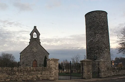
Inniskeen provides route-area context; this is not a map of the 2026 Monaghan Way diversion. Photo: Cathar11 · CC0. Resized and converted for the web. Full credit.

The Monaghan Way links Inniskeen with the southern side of Lough Muckno through farmland, lanes and remnants of railway country. Its variety is part of the appeal, but current route information matters more than an old guidebook line. A damaged bridge near Lannat is closed, and walkers must use the approved reroute.
Download the updated route
The local manager provides files marked as updated in 2026. It explains that the reroute adds distance to the Way and the Magoney Loop, while access to the old bridge and adjoining field has been revoked. Do not approach those places on the assumption that a historic walking line remains valid.
Read the current scale
Sport Ireland lists 19.6 kilometres and a moderate grade. Older publications give different lengths and sometimes a much longer historic route. Match transport and timing to the version actually being walked, including the exact permitted start and finish rather than a general Castleblayney town pin.
Remember the working fields
Much of the route depends on landowner consent. Keep to the waymarks, leave gates as directed and give livestock room. Railway history and river views are good reasons to look, but neither creates access beyond the signed trail or permission to enter an old structure.
Before you go
Check the manager’s latest safety notice before departure and follow signs for the updated route. Dogs are not permitted on the national trail. Wear suitable boots, carry a reliable map and allow for wet ground, climbs and road sections. Arrange collection or a return journey because this is a linear walk. The Inniskeen and Toome loops are separate shorter options, not an automatic shortcut around every restriction. Do not use an old photograph to decide a damaged crossing looks passable. If conditions or daylight do not fit the route, choose another confirmed walk rather than compressing the whole Way into the time remaining.
Plan your visit
Monaghan Integrated Development: 2026 maps and bridge safety notice · Sport Ireland: Monaghan Way current route data
More in Monaghan
Monaghan Town Greenway: walk the open canal section · Explore the county guide
Have a story to share?
Tell us about a place, a journey or a different side of Ireland. Send your article to the Ramble editorial team for review.