
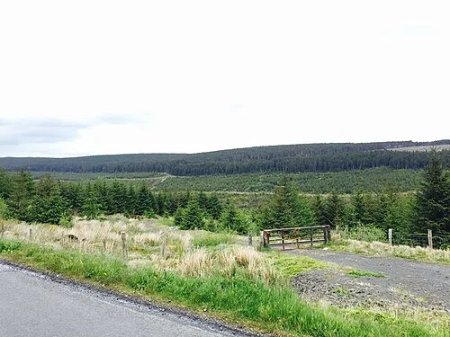
Photo: Dean Molyneaux · CC BY-SA 2.0. Resized and converted for the web. Full credit.

Banagher Forest offers a more substantial walking prospect than a small town park. Forestry roads and paths follow the Glenedra and Altnaheglish valleys, with a reservoir higher in the landscape. Decide your route, distance and return before starting: the forest service specifically notes that the network is not waymarked.
Read the different woodland settings
Much of the forest was planted with conifers on peat-covered slopes, while richer valley ground carries different trees. Watching those changes gives the walk another interest beyond reaching the reservoir. Keep to the permitted roads and paths so the ground underfoot does not become an improvised route through steep or wet vegetation.
Choose a distance you can navigate
The land manager describes a long circuit linking the two glens, not a short signposted family loop. Use a suitable map and current route information if considering it. A shorter planned out-and-back may be a better choice, provided you can identify the return and have checked that the chosen section is open.
Respect the reservoir and working forest
A view over the water is a landscape stop, not permission to swim, camp or enter operational infrastructure. Forestry work can restrict roads and paths, and the absence of waymarkers makes a closed link particularly important. Follow diversions and turn back if the available route no longer matches the outing you prepared for.
Before you go
Check current access, weather and daylight and carry the navigation, food and clothing appropriate to your chosen distance. Tell someone your plan for a longer outing. The forest can be approached from the Draperstown–Feeny road area using official directions; do not rely on a nearby residential postcode as the exact trailhead. Avoid shortcuts across private land.
Plan your visit
NI Direct — Banagher Forest · Forest Service — current access news
More in Derry
Carntogher: choose the mountain trail from the heritage map · Explore the county guide
Have a story to share?
Tell us about a place, a journey or a different side of Ireland. Send your article to the Ramble editorial team for review.